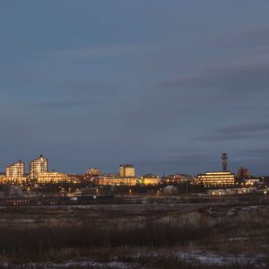
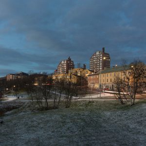
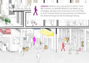
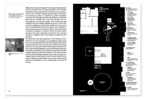
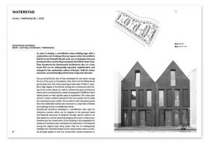
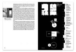
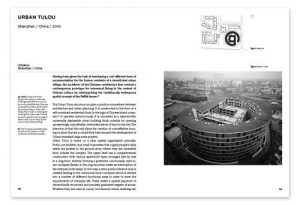
Archives: all-projects

all-projects werden im Portfolio angezeigt.

Kiruna

The article is the result of a research trip, conducted together with Mark Kammerbauer, to the mining town of Kiruna, 140 km north of Sweden’s Arctic Circle. The city is known for its mining of iron ore. Every day, an amount of steel sufficient for the construction of six Eiffel towers is being mined. Since 2012, mining has been carried out underground to a depth of just less than 1,400 m. The miners are brought to work in buses on about 400 km of underground roads; there is WLAN in every tunnel. Two thirds of the urban population works in the mine; the inhabitants call it “mother”.

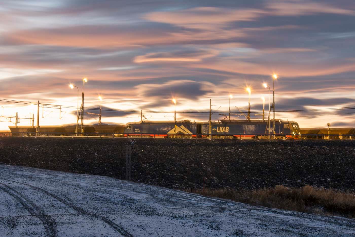
Blasting takes place every day after midnight. A 20-ton elevator brings 40 tons of ore to the surface per trip. The raw material is transported in long freight trains to the port in Narvik (Norway) from where it is shipped out. About 95% of European metal products are produced with iron that originates from Kiruna.

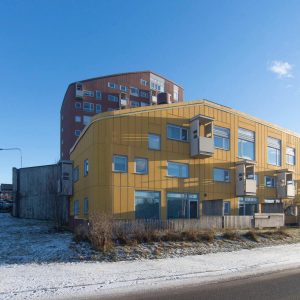
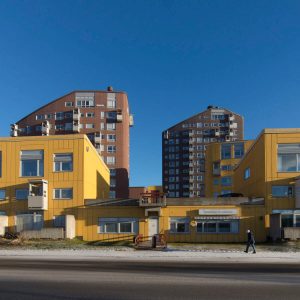
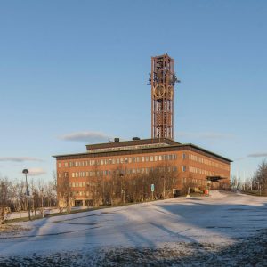
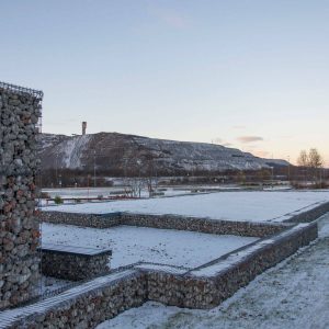
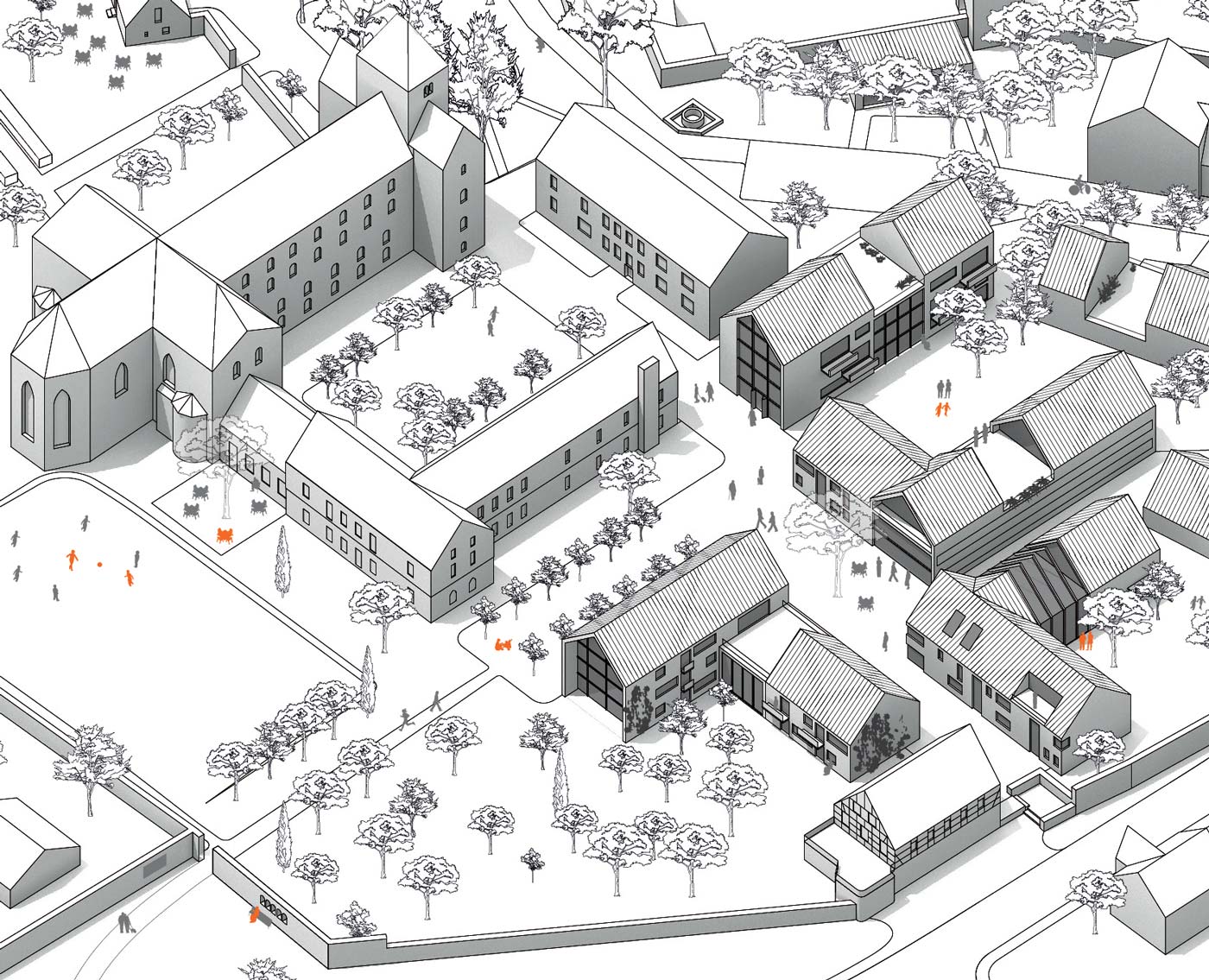
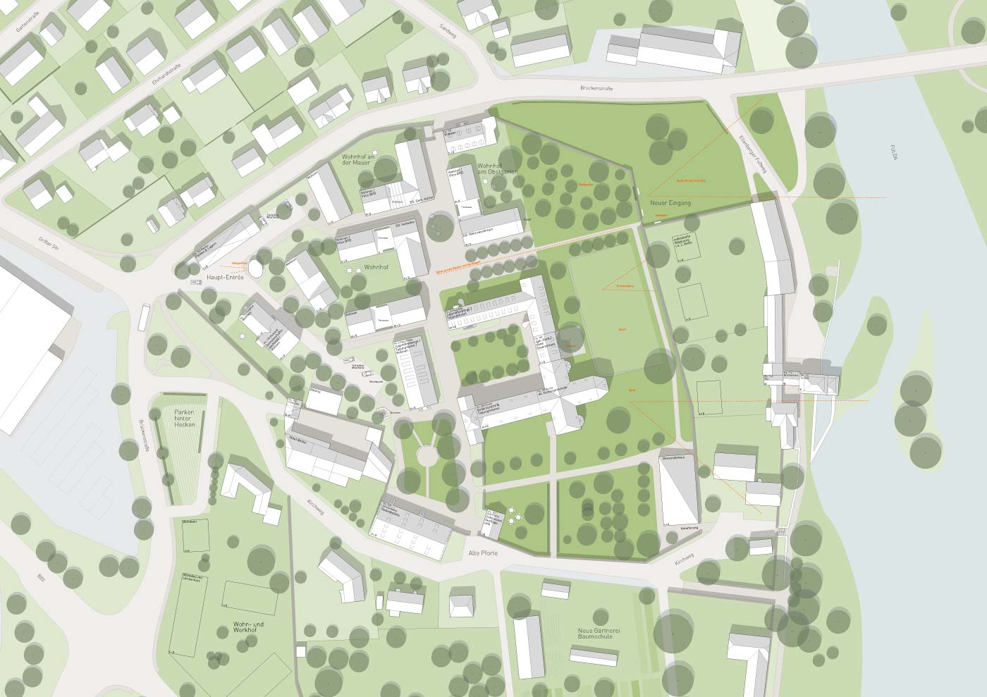
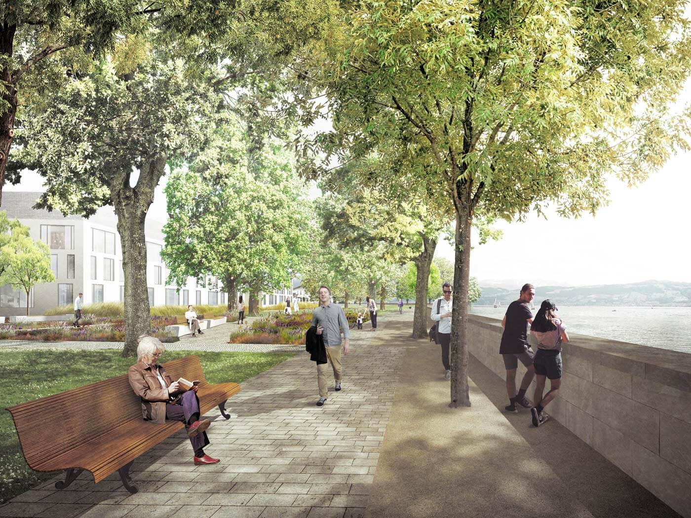
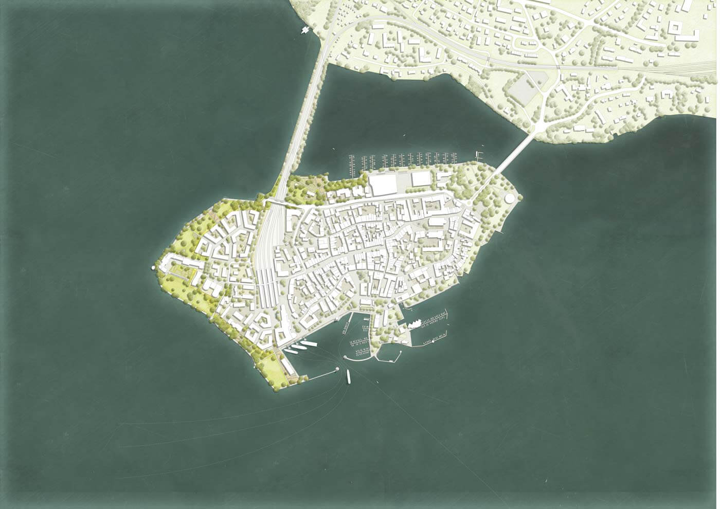
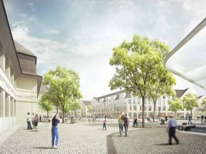
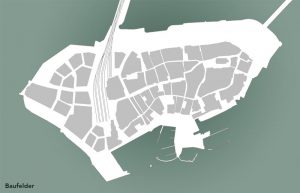
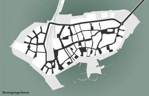
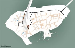
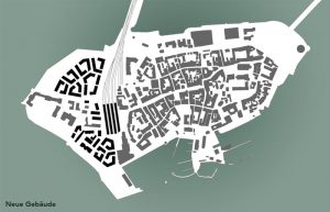
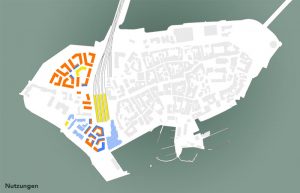
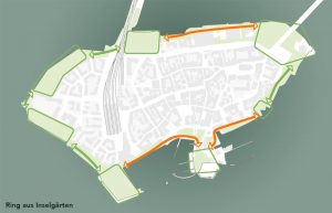
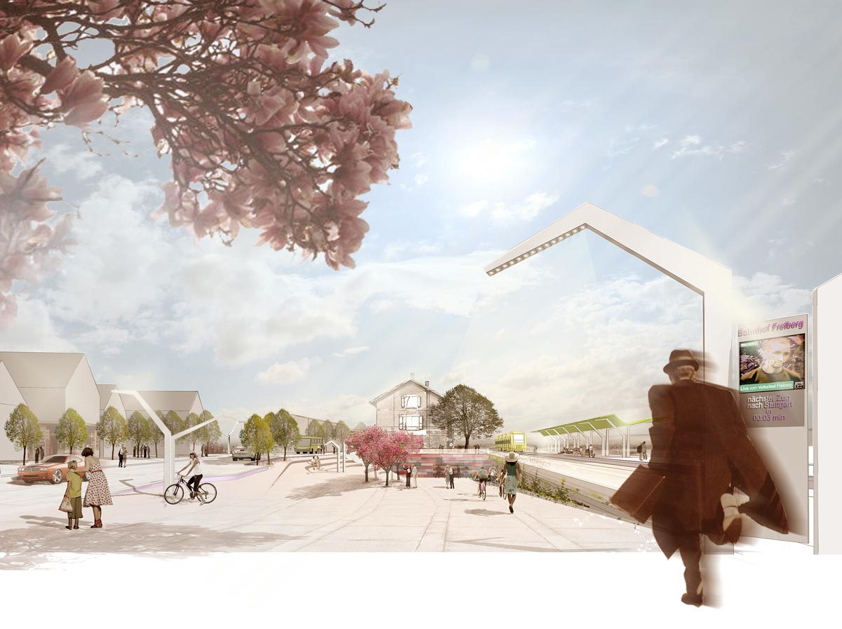
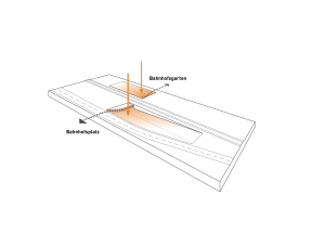
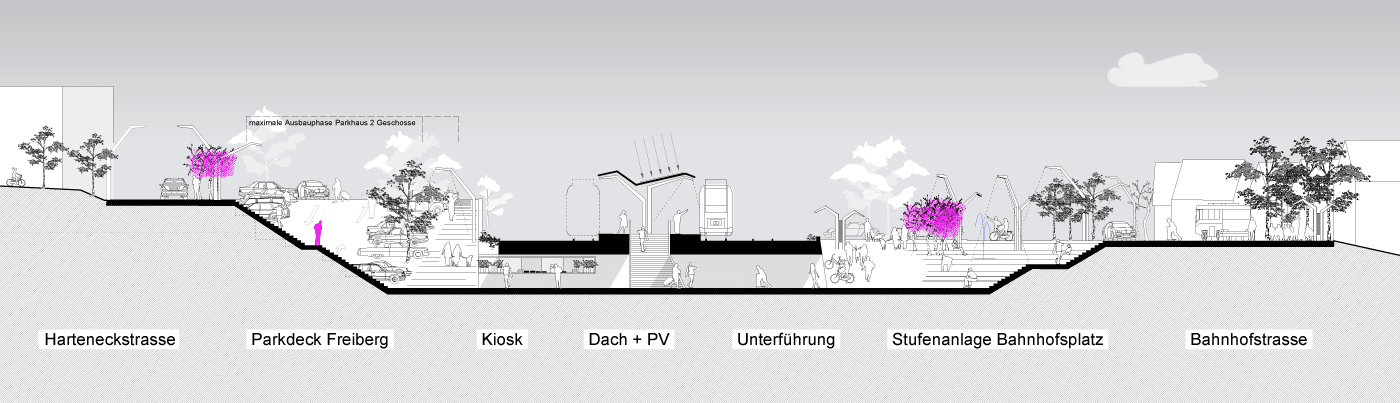
For some years now, mining has increasingly been undermining the city. In particular, the centre of Kiruna is located on a growing deformation zone and is to “move” on the basis of a master plan. A new town hall is being built on safe ground, a greenfield site, approx. 3 km from the city. Some of the valuable buildings will be dismantled and rebuilt in the new centre. Another part will be destroyed, e.g. the listed town hall by architect Artur von Schmalensee and the residential ensemble Ortdrivaren by Ralph Erskine (images below). Kiruna is thus undergoing one of the largest urban transformations in Europe. For more information: Topos no. 102.

The photo documentation on Ortdrivaren was made available to the archive of the Centre for Architecture and Design in Stockholm, Ark Des (Photos: Joachim Schultz-Granberg).


Mark Kammerbauer, Joachim Schultz-Granberg: Dark Metal in Kiruna – What happens when the lights go out in a mining city?  – in Topos 102, 2018 (p.50) >>


Topos Darkness Kiruna Stadtforschung


SSG Kiruna Stadtforschung 03

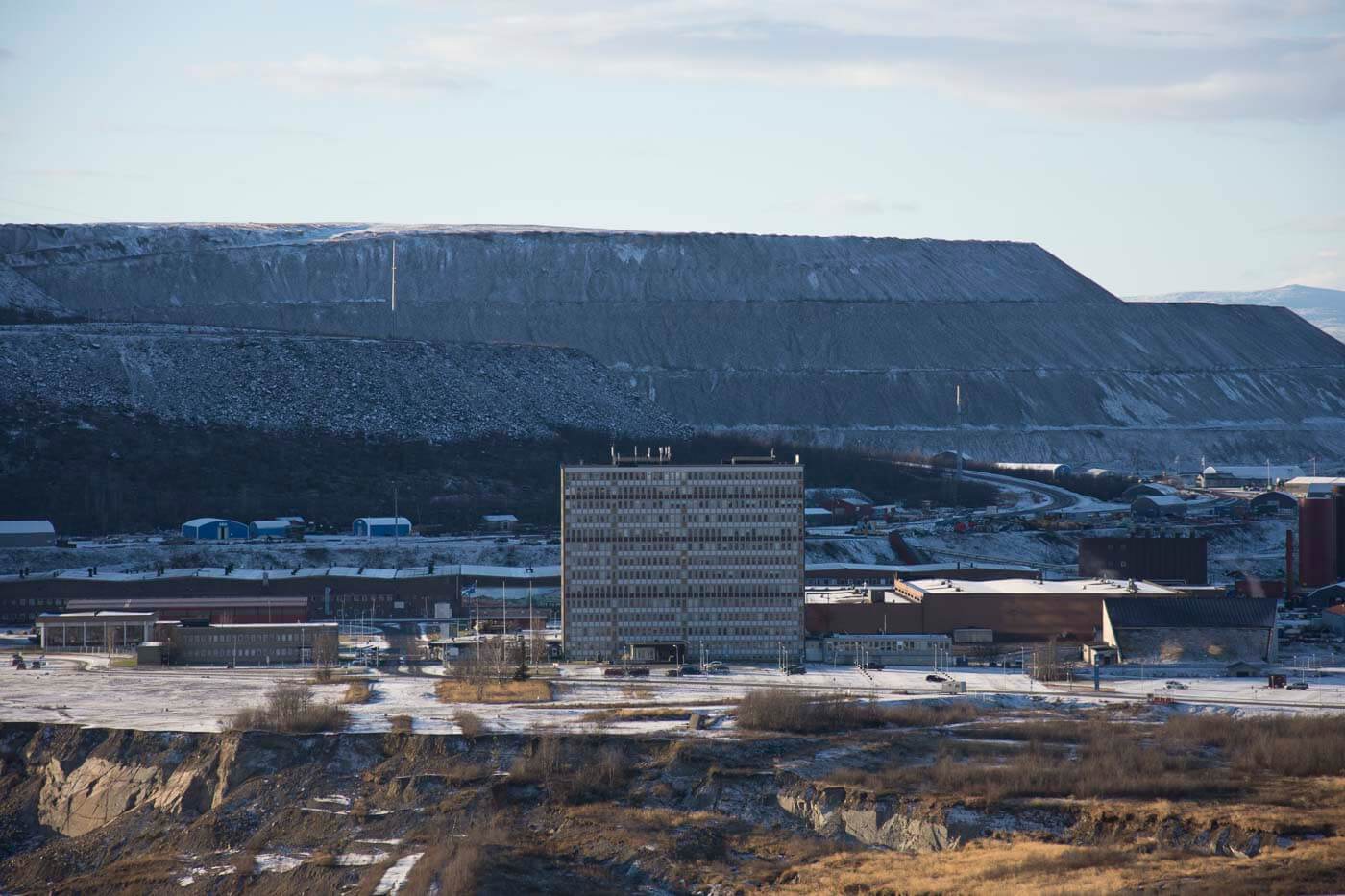
view over the main building and the mine

Kiruna Vedute

Planned Demolition:Oortdrivaren, Ralph Erskine

Planned Demolition:Ortdrivaren, Ralph Erskine

Planned Demolition:Ortdrivaren, Ralph Erskine

Planned Demolition: City Hall, Artur von Schmalensee (1958)

Park ontop on Ruins of demolished Houses

Bazaar Berlin

“It’s not a question of refugees but rather a question of integrated housing” – Bazaar Berlin, the new founder city – is a versatile and flexible living and working structure for refugees, low-income people as well as creative and committed citizens. A city for arrivals.

SSG Basar Berlin Cuvrybrache Staedtebau


SSG Basar Berlin Module

The project addresses the core idea of living and working as the basis for social integration. This is illustrated by the combination of tried and tested urban elements into a larger complex in which integration can take place on different levels. For a start, there is a ground floor base with commercial units, arranged on the model of the bazaar, providing compact working spaces for residents. On top of the bazaar, basic modules for living, in a range of different apartment sizes, offer accommodation for different types of inhabitant. The insertion of open space between the modules promotes communication and enables connection between residents. The concept was regarded as convincing since it responds both to the request for mixed use and the interest in the specific location on an urban wasteland called the Cuvry-Brache in Kreuzberg. The project offers integration in the local environment and a productive use of city space.


Competition “City in Transition – City of Ideas”, 2nd prize


Programme: Concept for a versatile arrival city

Location: Cuvrystraße (exemplary for Berlin, GER)

Year: 2016

Promoter: www.plattformnachwuchsarchitekten.de

Team: Joachim Schultz-Granberg, Therese Granberg, Tobias Grothues

Partner: Ziegert | Roswag | Seiler Architekten


SSG Berlin Award Grundrisse


Johanna

Ahmed

Stefan & Ali

further projects on the topic living
Publication Bezahlbar. Gut. Wohnen

Affordable Living

Housing is a basic entitlement to which many people in all regions of the world still do not have, or have only inadequate, access. Architecture and urban development can make a contribution to finding new approaches to ensure that housing is available to all.

The challenge of affordable housing is to balance costs and living value in an optimised way. How to achieve this depends on many local parameters, cultural influences and political will. Against this backdrop, the book presents not only theoretical approaches, but also strategies for the creation of affordable housing using outstanding residential buildings as examples.

A methodology that shows relative cost-benefit analyses and local average values makes cost-reducing parameters visible and different projects comparable. The simple, graphic presentation makes the problem clear even for the layman, without the need for a detailed understanding of cost ratios.


Klaus Dömer, Hans Drexler, Joachim Schultz-Granberg: Affordable Living – Housing for Everyone, Jovis, Berlin 2014


SSS Publkikation Affordable Living Titel shade


Klaus Dömer, Hans Drexler, Joachim Schultz-Granberg (Hg.)
Affordable Living – Housing for Everyone
2014
English
Broschure
14 x 19 cm
272 Pages, ca. 50 Colour. und 40 s/w Images.
ISBN 978-3-86859-324-2
Jovis Verlag (sold out)

further publications
Bezahlbar. Gut. Wohnen. (German revised edition)
City and Wind
Atlas IBA-Hamburg

Xeritown

Xeritown is a sustainable mixed-use development in Dubai. It provides housing for approximately 7000 inhabitants and is located in Dubailand, a planned extension of the city towards the inland desert. Instead of considering the site as a tabula rasa the urban structure reacts on local climate conditions.

The built up area has been compressed to occupy only 50% of the site as an immediate reaction to climate in order to achieve a compact shaded fabric: its structure is defined by alternating narrow pedestrian alleys and small squares, typical of Arabic towns. This urban tissue is divided in elongated islands that are orientated so to gain from the prevailing winds crossing the site. The cool breeze from the sea is channelled between the islands and through the longitudinal cuts in the urban fabric, while the hot wind from the desert is deviated above the development. Natural ventilation is enhanced by a rugged skyline breaking up airflows on the scale of both low rises and towers. Similar dynamics determine the formations of the dunes in the desert, thus the development appears as dune scape where the urban islands could be interpreted as a consolidation of the desert dunes.

The project applies a multitude of strategies for achieving an ecological quality and energy conservation like reducing energy demand by minimizing solar gains thanks to north-east orientation natural ventilation and earth pipes, dimmable LED street lighting, photovoltaic panels to generate low-voltage direct current electricity and roof top turbines; strategies for the conversion of recourses by the reduction of the demand of potable water thanks to low water-use appliances, grey water recycling for irrigation and water saving irrigation systems, low maintenance landscape, re-use of soil present on site and waste-recycling facilities, strategies to reduce carbon emissions by easy access to public transport and by extensive shaded and well ventilated pedestrian and cycling network.


Master Plan for a Sustainable City


Programme: 59 ha, GFA: 486.000 m2, apartments for approx. 7000 people and subsequent residential uses

Awards: Holcim Award 2008 for Sustainable Construction (Regional Acknowledgement Prize), Cityscape Architectural Awards 2008

Location: Dubai, United Arab Emirates

Year: 2006 / 2008

Client: Dubai Properties, United Arab Emirates

Team: SMAQ – architecture urbanism research: Sabine Müller, Andreas Quednau mit Joachim Schultz-Granberg, Team: Therese Granberg, Ludovica Rogers, Felipe Flores, Kathrin Löer, Valle Medina, Martino Sacchi

Partners: X-Architects (Dubai), Johannes Grothaus Landscape Architects (Potsdam/Dubai), Reflexion (Zürich) Licht, Buro Happold (London) Infrastruktur und Nachhaltigkeit


Sustainable Masterplan Xeritown SSG plan

50% arid landscape

two winddirections

program

infrastructural provision


public roofing with photovoltaics


Sustainable Masterplan Xeritown-SSG-diagram wind axonometry-t

Sustainable Masterplan Xeritown SSG sections-t

left: Cross section – the proportions of the narrow corridors between the buildings guide the wind across the roofs to the right: longitudinal section – wind flows between the buildings and cools the public space


projects wirh similar themes
Research Project “City and Wind”

Dubai Metrozone

City and Wind

The research focus was developed as an interdisciplinary project with architects, planners, engineers and climatologists. The publication gathers together knowledge about urban and architectural prototypes in the context of climate and identifies principles and mutual dependencies of climate, city and architecture with a particular focus on wind currents and ventilation.

Architecture is often defined as a means of protecting against the climate, which is a physical but also a psychological threat – architecture as hermetic protection against rain, heat and wind. However, an alternative point of view can highlight the importance of climate for architecture. Climate ‘localizes’ architecture and makes it multi-layered, complex and unpredictable.

Climate has had a significant influence on architecture for centuries. Orientation, form and materials have been the logical consequence of local conditions for a long time. This has resulted in the many different traditional architectural styles that have their own regional characteristics and resources. Examples are the wind towers in the Middle East or the low roof slopes in the Alps. These intelligent architectural expressions make use of local climatological aspects.

Urbanisation and technological progress have meant that climate rarely plays a role as a shaping instrument for architecture. The publication is a call to see architecture not only as a means of protecting against the climate, but to work creatively with the elements of wind and weather: ‘We can’t change the wind, but we can set sails differently’ (attributed to Aristotle).


Mareike Krautheim, Ralf Pasel, Sven Pfeiffer, Joachim Schultz-Granberg: City and Wind – Climate as an architectural Instrument, DOM Publishers, Berlin 2014

Flow simulation: Prof. Dr. Hans-Arno Jantzen, Hochschule Münster >>

Climatology: Prof. Dr. Otto Klemm, WWU Münster >>

Consulting: Prof. em. Dr. eh. Klaus Daniels (HL-Technik), Dr. Peter Mensinga (ARUP), Dr. Mohannad Bayoumi (Architekt), Christophe Barlieb (Architekt)


SSG City and Wind Titel


SSG City and Wind best practice

Content

The first part, “EXPERIENCING THE INVISIBLE”, sheds light on the complex phenomenon of wind: sensors, art, wind power, flow behaviour, mapping, and protection against wind, even wind gods are examined. The results flow into the “World Map of Wind”. The second part, “METHODS AND INSTRUMENTS”, describes analogue and digital empirical investigations and tells the short story about wind effects. The third and final part, “DESIGNING WITH WIND”, systematically examines traditional and new best practice projects:

  • Masdar City, Abu Dhabi
  • Xeritown, Dubai
  • Mangh, Pakistan
  • Badgir, Iran
  • Malquaf and Dur Qa’a, Egypt
  • Druk White School, India
  • Lyceé Charles de Gaulle, Syria
  • School Complex, Burkina Faso
  • Semiramis, Morocco
  • Space Block, Vietnam
  • Tjibaou Center, New Caledonia
  • Airtree, Spain
  • Interior Gulf Stream, France

SSG City and Wind World Map of Wind Web legend


The book launch was accompanied by a series of symposia in Berlin, Rotterdam and Münster.

SSG City and Wind Symposium Design

29.05.2014  Symposium Climate and Design
Kunsthal Rotterdam, NL @ International Architecture Biennale Rotterdam IABR 2014 – Urban by Nature

Duzan Doepel (Doepel Strijkers, Rotterdam), Peter Mensinga (ARUP, Amsterdam), Mareike Krautheim (Architect, Berlin/ Rotterdam), Ralf Pasel (TU Berlin/pasel.künzel architects, Rotterdam), Sven Pfeiffer (MSA), Joachim Schultz-Granberg (MSA)

SSG City and Wind Symposium Planning

01.07.2014  Symposium Climate and Adaptation
ANCB – Aedes Network Campus Berlin

Sanda Lenzholzer (TU Wageningen), Mareike Krautheim (Architect, Berlin/Rotterdam), Ralf Pasel (TU Berlin/pasel.künzel architects, Rotterdam), Sven Pfeiffer (MSA), Joachim Schultz-Granberg (MSA)

SSG City and Wind Symposium Adaptation

11.06.2014 Symposium Climate and Planning
Münster School of Architecture @ Stadtansichten

Klaus Daniels (HL-Technik, München / ETHZ), Eric Frijters (FABRIC, Amsterdam), Hans-Arno Jantzen (Flow simulation, FH Münster), Otto Klemm (climatology, WWU Münster), Chris van Langen (Dean Rotterdam Academy of Architecture and Urban Design), Stadtdirektor Hartwig Schultheiss (Münster), Mareike Krautheim (Architect, Berlin/Rotterdam), Ralf Pasel (TU Berlin/pasel.künzel architects, Rotterdam), Sven Pfeiffer (MSA), Joachim Schultz-Granberg (MSA)


Mareike Krautheim, Ralf Pasel, Sven Pfeiffer, Joachim Schultz-Granberg
City and Wind – Climate as an Architectural Instrument
2014
English
Softcover
210 × 230 mm
208 Pages
274 Images
ISBN 978-3-86922-310-0
DOM Publishers

further publications
Bezahlbar. Gut. Wohnen.
Affordable Living
Atlas IBA-Hamburg

Dubai Metrozone

SSG Dubai Metrozone Jaffiliya

Dubai is known as a city of superlatives. Before the financial crisis of 2008, countless real estate projects developed in rapid succession, expanding both along the coast and into the desert. With the construction of the Dubai Metro in 2005, one of the largest infrastructure projects in the Persian Gulf was created. Dubai Metrozone investigated the potential for future transformations.

Dubai is known as the capital of superlatives: it is famous for the highest free-standing hotel in the world, the largest artificial islands, the largest shopping centre, the tallest high-rise on the planet (Burj Khalifa, towering at 828 metres)… The city is also growing rapidly. Over the past few decades its population has increased six fold. An expansive urbanism of competing master plans has established itself, striving for uniqueness on the battlefield of iconic architecture. Each project so far has been built as a separate, isolated theme world.

However, as an infrastructure project, the construction of the Dubai Metro offers new perspectives for everything that has previously been done: real estate values will rise in proximity to the stations. Compression and intensification will open up design possibilities for new urban typologies. And a new type of actor will appear: the pedestrian, who will no longer rely solely on the car for their movement. Perhaps the Metro will become the starting point for new dynamic and social interactions in a lively open space: the Metrozone.

This perspective triggered the idea of a 4-metre large, speculative map for the “Dubai Metrozone”. The constantly evolving infrastructure shows options for potentially new urban typologies. The map was exhibited within the framework of Parallel Cases in occasion of the 2009 edition of the International Architecture Biennale Rotterdam.


Exhibition at the Parallel Cases of the International Architecture Biennale in Rotterdam, IABR 2009

Team: Joachim Schultz-Granberg, Alexandra Böcker, Julian Münzel, Andreas Rauch, David Serrao, Jenny Wahren, Andrea Wycisk

Partner: Rebal Knayzeh (Fotos), Adina Hempel


SSG Dubai Metrozone

SSG Stadtforschung Dubai Metrozone


WHEN I WAS SIX …   I fell and fractured my arm and dislocated my elbow. I was rushed to the hospital where the next thing I remember is waking up with a dry mouth and a cast on my arm. Now I boast a 14-stitch scar on my left arm. Dubai will soon boast its own scar, the result of an extensive operation that requires deep incisions, a broad cast and that hopefully heals quick enough to rectify the damage that necessitated this operation in the first place. The scar for all to see is the elevated track of the new Metro Dubai.

The streets of Dubai today are the epitome of temporary solutions, temporary diversions on its highways, temporary signage temporary traffic lights. Look a little further and you would realize that Dubai’s entire population is there on temporary basis. That may be why no one cares to leave his or her mark. There is no graffiti, no public art, there is no public civic space to begin with. (…)

The changes that we may anticipate are numerous, and the repercussions are hard to predict. No one from Le Corbusier, to Jane Jacobs, to Lewis Mumford with their diametrically opposed yet similarly western theories can predict the outcome of this “old” mode of transportation.

Will rent in the areas closest to the stations rise? Or will the inhabitants rush to quieter locations.  Will people actually use it and if they do will they accept sharing the same car with others from every rank and walk of life? Will this new “easy” mode of transportation bring the much feared, much hidden face of Dubai, the swarms of Asian laborers into the city on the weekends? This is the ultimate test of public interaction. It is easy for car drivers to pass by the many labour transportation buses on the congested highways and complain about the ogling eyes of many of the workers. Would the same people accept sharing the same bench on the train with the workers?

Rebal Knayzeh (Text und Fotodokumentation des Baus der Metro Dubai)

related projects
Xeritown  Masterplan in Dubai

Guxhagen

The former Breitenau monastery complex is the result of centuries of additions and alterations, demolitions and structural amendments – a history full of breaks. The discontinuities are continuous and convey an impressive spatial diversity and scenic charm. Now the Breitenau monastery is to be opened as a residential quarter. The proposed building and conversion measures form a structure of public open spaces intertwined with private retreats, all to create an inclusive coexistence of different users.

Benedictine monastery, workhouse, concentration camp, Gestapo camp, girls’ home, memorial… how can the spatial structure of this building ensemble be adapted for contemporary forms of living without compromising its public use as a memorial and meeting place?

The existing buildings, courtyards, towers, staircases, walls and paths are the historical “deposits of human effort” under different auspices and ideologies. A “tidying up” in the sense of geometric severity and superimposed order would be the wrong way forward, because the seemingly random, often offset, twisted and disordered arrangement of the buildings makes up the charm and quality of the monastery complex. The master plan offers the opportunity to open the building ensemble to mixed forms of living and public life for the streams of visitors. The parallelism of living and care for the complex’s eventful history make commemoration part of everyday life and history vivid.


Competition Master Planning Guxhagen-Breitenau


Programme: Further development of the Breitenau Monastery Memorial as a place of residence, approx. 8 ha

Location: Guxhagen, DE

Year: 2018

Client: Vitos-Kurhessen

Team: Joachim Schultz-Granberg, Therese Granberg, Daniel Heuermann


Pavilion at Entrance

Living Quarter

Former Airfield Tempelhof

SSG Tempelhof Prozessuale Entwicklung Perspective

The referendum of the 25th of May 2014 prohibits not only the erection of buildings on the former Tempelhof airport, but also the design of the missing links to the surrounding quarters. This project was a contribution to the competition Parklandschaft [Park Landscape] 2010, and it developed strategic instruments for process design and urban qualities in harmony with temporary actions.

The rear of the former runway, the residual and between spaces on the periphery of the former airfield represent the unwanted legacy of the well-known label “Flughafen Tempelhofî” If it is about the potential development opportunities of this impressive open space, then it must be achieved by way of the qualification and linking of the periphery with the existing adjacent neighbourhoods.

A context-oriented access road weaves through the open space linking the existing circular taxiway with surrounding quarters and the interior park landscape.

As a landscape framework, the surrounding stretch of woodland ensures stability for the future development of the entire area. It adopts functions and activities by way of the arrangement of surfaces, and integrates these as natural, or later, urban clearings, depending on the demand and degree of activity. As a basic spatial framework, the wooded area will then function as background vegetation to the procedural motor of the Tempelhof of tomorrow. Thus, the historical level will be overlaid by a contemporary level capable of both change and of doing justice to the variables and differing standards of a future modern park landscape.


Landscape planning competition


Programme: Re-use of the 384 ha Tempelhof airfield as an urban park landscape and development of a set of rules for procedural strategies

Client: City of Berlin

Location: Berlin-Tempelhof, DE

Year: 2010

Team: Joachim Schultz-Granberg, Felix Büttner, Philipp Quack

Partner: Hager Landscape


SSG Tempelhof Prozessuale Entwicklung Nutzungsplan

SSG Tempelhof Prozessuale Entwicklung Prozesstool


Lindau

The high-quality public open spaces of Lindau lie along the shores of Lake Constance and are oriented towards the open water area and the Alpine panoramas. Together with the existing parks and green areas our new design forms a continuous open space system of island gardens to make Lindau a “waterfront garden city”.

A new residential quarter is being created on the site of the former P5 car park. Its basic structure reflects the medieval land parcels of the area. The residential streets will be designed as shared surface. In the centre of the quarter is a tree-lined square with a fountain. The elevated inner courtyards of the residential block offer tranquillity and privacy.

The basic typology is a space-creating block structure that consists of a plinth with building cubic shapes, a residential courtyard and specifications for the roof shape in accordance with the Lindau design guidelines. These are the ingredients for the typological formula, which can be modified according to the situation: Height, size and shape of the building block adapt to different situations inside the quarter. The elevated courtyard shields residents from the streams of tourists and can alternate in height according to the way the surrounding street is built. In this way, it creates different situations for meetings, stops, encounters, and leisure.


Competition for the realisation of Hintere Insel Lindau, recognition


Programme: Garden show, living and subsequent living uses, approx. 8 ha

Client: City of Lindau

Location: Lindau at lake Constance, DE

Year 2016

Team: Therese Granberg, Joachim Schultz-Granberg, Tobias Grothues, Simon Wienk-Borgert

Partner: bbz landschaftsarchitekten berlin


Station Square

Riverside Promenade


Station Area

Gentle slopes situated to the north and south of the main train station largely replace the narrow pedestrian underpass and connect the neighbourhoods separated by Bahnhofstrasse.

The station forecourt in the north forms a kind of public lobby for the city, which is fitted with a generous, south-facing stairway along its longitudinal flank. To the south, a terrace-formed garden faces the adjacent quarter and mediates the existing height differences. Passers-by can linger here for a while.

The new northern course of the Bahnhofstrasse widens a previously unusable residual strip, creating buildable vacant lots. Terrace houses with a view of the Neckar valley lie on the steep slope. At the same time, the relocation of the road concentrates the noise emissions from rail and street traffic and, thus, supports the financing of the enterprise as a whole through the land sale of public property.

In the first phase, immediate actions at minimal costs are proposed, emblematically marking out the forthcoming urban development: existing fruit trees in front yards will be complemented by new plantations in public spaces; scrapped rail carriages incorporate the “rolling programme”, and street furniture, especially developed for the area, provides for lighting, information and orientation.


Contract for urban redevelopment, 1st prize


Programme: Design of the access to the railway station and master plan of the approx. 18 ha large railway station environment. Part of the exhibition Realstadt – Wünsche als Wirklichkeit Berlin 2010

Teil der Ausstellung Realstadt – Wünsche als Wirklichkeit Berlin 2010

Location: Freiberg am Neckar, DE

Year: 2009

Client: City of Freiberg a. N.

Team: Joachim Schultz-Granberg

Partner: Kubeneck Architekten


Masterplan Freiberg Schnitt WEST


Phase 1

Phase 2

Phase 3


Masterplan Freiberg SSG


similar projects
Domhof, Vreden